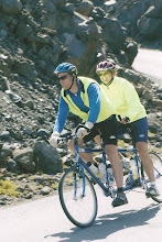
Peak on Saturday! The trip included 2-3 miles of
climbing until we reached the turn off for the base of
the peak. At that point, we started over nine miles
of uphill climbing until we reached the top. Both of
us were thankful for shade on the road, and the two
waterfalls on the side of the road along the way. We
were able to stop and splash water on our faces and
arms to cool off a little. The trip was beautiful!
For the last couple of miles we could look through the
trees and see the blue sky over the valley. The view
at the top was wonderful...cool and windy but
wonderful. We meant to bring our camera, but forgot
it at the house, so unfortunately, we have no photos
to share of this trip.
The ride going back home was a blast! We are glad
our brakes worked! Our top speed down the Peak was
about 45mph...contrasting to our 2-5 mph up the Peak.
Then we rode all the way up the hill where my parents
live. Although, not as steep as the Peak, the hill
is a major challenge on a tandem! When we pulled
into the driveway we felt we had had reached a new
level in our training.
A little about Mary's Peak:
* Mary's Peak was originally called Chintimini by the
Native Americans. it was renamed by the early
settlers Mary's Peak along with the Mary's River most
likely after Saint Mary.
* Mary's Peak is the highest Peak in the Oregon
Coastal Range north of Coquille. (Over 4,000 feet!)
* Mary's Peak offers several opportunities for
recreation. For more information on Mary's Peak:
http://en.wikipedia.org/wiki/Marys_Peak
____________________________________________________________________________________
Shape Yahoo! in your own image. Join our Network Research Panel today!


No comments:
Post a Comment